Garmin GPSMAP 378 Chartplotter
Garmin Updated: 2008-09-17 RSS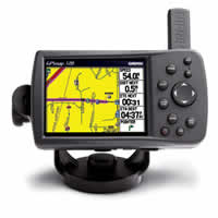
Go straight from the box to your boat to your vehicle with the portable GPSMAP 378. Along with its counterpart, the GPSMAP 478, this combination color chartplotter and street navigator comes preloaded with detailed marine maps and detailed street maps, so you can find your way anywhere.
Head Straight for the Water
Ready for action right out of the box, the GPSMAP 378 comes preloaded with detailed U.S. Inland Lakes data, which boasts 10-meter resolution for more than 3200 lakes, many with depth contours. In addition, these built-in freshwater maps provide shoreline detail, river and creek channels, islands, boat ramps, campgrounds and more for tens of thousands of lakes across the continental U.S. — giving you the freedom to boat and fish anywhere in the states. The maps also show streams and rivers, tide stations and predictions, a wrecks and obstructions database and U.S. Coast Guard aids to navigation.
Go from Water to Land
When you're ready to drive home, take your 378 out of its marine mount and pop it into the automotive mount in your vehicle. Then press one button, and your 378 is ready to navigate you on the roads, with turn by turn directions and voice prompts that take you straight to your destination. The 378 is preloaded with detailed City Navigator maps for all of North America and contains over 6 million points of interest, including hotels, restaurants, gas stations, marinas, attractions and more.
Add Optional Weather, Audio and Sonar
See real-time weather on the 378's high-resolution TFT with the purchase of a GXM 30 XM antenna and a subscription to XM Satellite Weather and Radio services. View vital weather data, including NEXRAD radar, storm cells, wind speeds, surface temperatures, forecasts and more than a dozen other weather attributes, so you can enjoy the water without worrying about the weather. You can also subscribe to XM Satellite Radio to receive over 100 channels of commercial-free music, sports, news and talk radio.
For serious fishing, pair the 378 with the GSD™ 21 remote sounder, which offers 4,000 watts of power peak-to-peak (500 watts RMS) with a dual-frequency transducer (purchased separately).
Add More Marine Maps
The 378 accepts optional MapSource data cards, so you can add new maps without connecting to your computer. Optional BlueChart g2 data cards let you view real, detailed aerial photos of harbors, marinas and other important marine landmarks and places, right on your chartplotter.
GPSMAP 378: Loaded and ready for action, right out of the box
Spec Sheet
Owners Manual
Quick Reference Guide
Related Manuals
Garmin GPSMAP 278 Chartplotter
Garmin GPSMAP 478 Chartplotter
Garmin GPS 152 Chartplotter
Garmin Fishfinder 400C Color Sounder
Garmin Fishfinder 300C Color Sounder
Garmin Fishfinder 160C Sonar
Garmin Fishfinder 140 Sonar
Garmin Fishfinder 90 Sonar
Garmin GMR 18 HD Radar
Garmin GMR 24 HD Radar
Garmin GHP 10 Marine Autopilot System
Garmin TR-1 Gladiator Marine Autopilot