Garmin GPSMAP 4008 GPS Chartplotter
Garmin Updated: 2008-09-17 RSS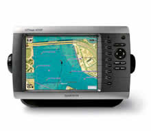
The power of networking meets the brilliance of great design in this chartplotter, which serves as your all-in-one "nerve center" for the Garmin Marine Network. The GPSMAP 4008 has video-quality resolution on an 8.4" VGA display as well as a worldwide, satellite-enhanced basemap. By connecting to the Garmin Marine Network, you can add sonar, radar and weather. For even more enhanced features, you can add the optional BlueChart® g2 Vision card.
View Detailed Graphics and Video
The 4008 features a worldwide basemap with high-quality satellite images in place of more traditional maps. And for more detail, you can add maps easily with the SD™ card slot without having to connect to a computer. The 4008's high-speed processor draws maps quickly, and its simple intuitive interface makes navigating easy. To keep tabs on your engine room or other area of your boat, you can also connect a live video feed with the 4008's video input and output options.
Add Extras with BlueChart g2 Vision
With the optional BlueChart g2 Vision SD card, you can add a whole new dimension of exceptional features to your chartplotter.
* 3D mariner's eye view or fish eye view provides you with a 3-dimensional perspective of map information, both above the waterline and below it.
* High-resolution satellite images and aerial photographs help you orient yourself in unfamiliar areas.
* Auto Guidance technology searches through all relevant charts to create a route you can actually follow — one that avoids obstacles, shallow water, buoys and other obstructions.
Connect to the Garmin Marine Network
The 4008 connects easily to the high-speed Garmin Marine Network, so you can interface with additional MFDs and add remote sensors. Once connected, you can share information between the 4008 and other chartplotters on your boat. You can also add high-powered radar, sonar and XM satellite weather and radio to your system.
Owners Manual
Quick Reference Guide
Installation Instructions
Flush Mount Template
Remote Instructions (Multilingual)
Related Manuals
Garmin GPSMAP 3210 GPS Chartplotter
Garmin GPSMAP 4010 GPS Chartplotter
Garmin GPSMAP 4012 GPS Chartplotter
Garmin GPSMAP 4208 GPS Chartplotter
Garmin GPSMAP 4210 GPS Chartplotter
Garmin GPSMAP 4212 GPS Chartplotter
Garmin GPSMAP 5008 GPS Chartplotter
Garmin GPSMAP 5012 GPS Chartplotter
Garmin GPSMAP 5015 GPS Chartplotter
Garmin GPSMAP 5208 GPS Chartplotter
Garmin GPSMAP 5212 GPS Chartplotter
Garmin GPSMAP 5215 GPS Chartplotter